
Urban Underground Space Management
Map underground pipelines, fire protection systems, and critical infrastructure with high-precision 3D digital twins. Empower your urban planning with effective underground resource management.
Application Scenarios
Underground Pipeline Management: Visualize water, electricity, and gas networks with pinpoint accuracy. Plan and maintain complex underground systems more efficiently.
Underground Facilities: Monitor volume changes in waste stockpiles to generate critical data for pollution control and remediation efforts.
Monitor Underground Facilities: Track conditions in subway stations, parking structures, and commercial complexes in real-time. Prevent issues before they arise.
Enhance Emergency Response: Assess risks and plan evacuations faster. React quickly during critical situations with comprehensive spatial understanding.
Optimize Asset Management: Track maintenance throughout your facility's lifecycle. Reduce downtime and extend infrastructure lifespan with data-driven decisions.
Challenges Addressed
Manual Inefficiency: Overcome traditional survey methods requiring excessive labor like tape measures and total stations.
Accuracy Barriers: Eliminate errors caused by poor lighting, high humidity, and confined spaces that compromise traditional tool effectiveness.
Data Fragmentation: Resolve incomplete information collection where hidden areas and complex structures remain unmapped.
Safety Hazards: Eliminate unnecessary personnel exposure to poor ventilation, toxic gases, electrical dangers, and structural instability during extended manual surveys.
Data Delay: Overcome the inability to capture dynamic changes during ongoing operations.
The XGRIDS Advantage

Efficiency
Achieve 5 to 8 times faster data collection with a portable, single-operator system, even in complex environments.
Ease of Use
Capture real-time, true-color point clouds with "what you see is what you get" accuracy, powered by advanced Multi-SLAM for precise point cloud colorization.
Quick Data Processing
Efficient data processing through map fusion and concurrent dataset processing, yielding quick maps/profiles and easy AutoCAD integration via RCP export.
Actionable 3D Data
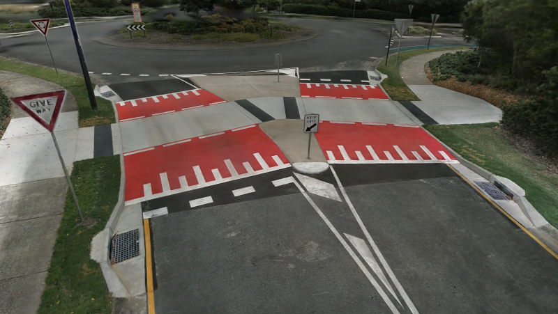
Integrate and reuse rich 3D models with clear textures and accurate real-world representation.
Hardware
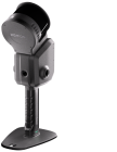
Lixel L Series
High-Precision 3D Scanner
Learn More >
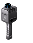
Lixel K Series
Compact 3D Scanner
Learn More >
Software

LixelStudio
Point Cloud Studio
Learn More >

Lixel CyberColor
Next-Gen 3D Content Format
Learn More >
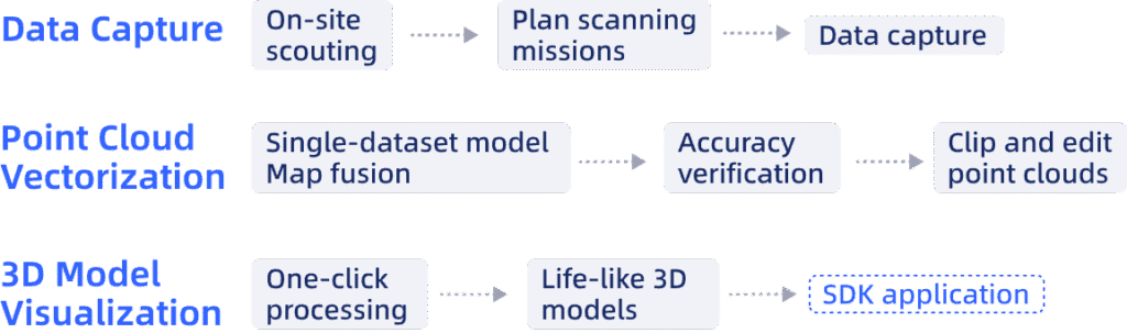
Workflow
Case Studies
50% Accelerated Full-Project Lifecycle Infrastructure QA Using XGRIDS LiDAR + 3DGS Solution - AECT SOLUTIONS in